

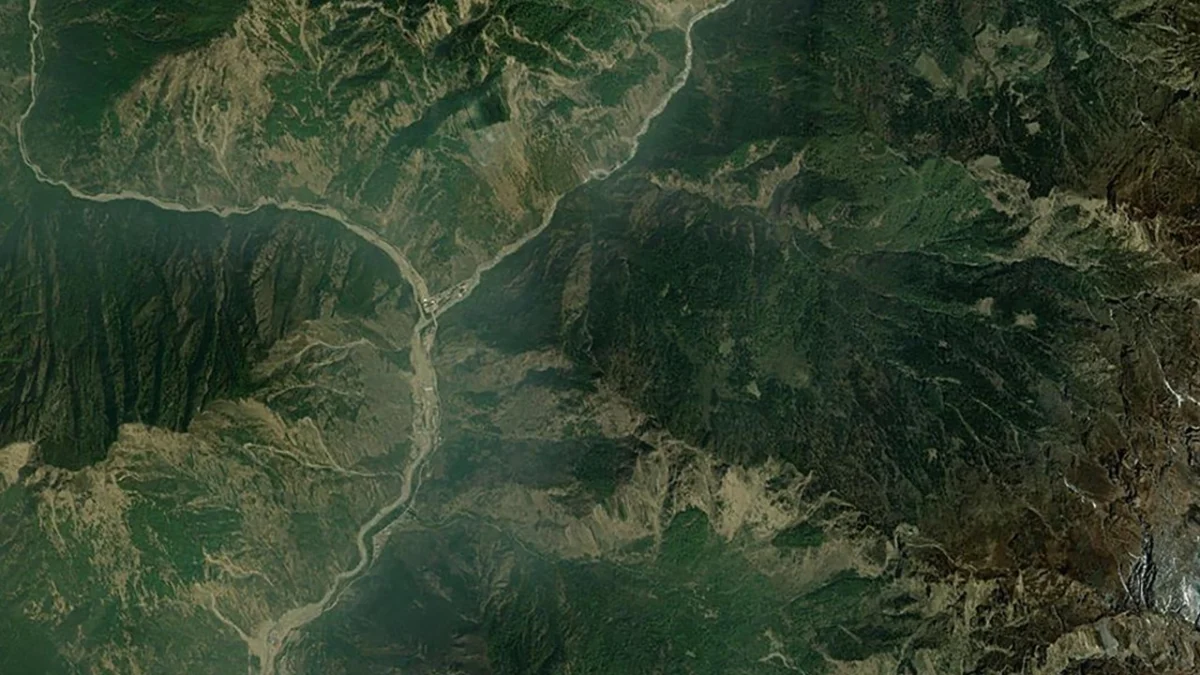
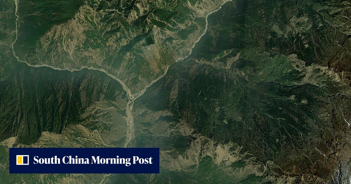
In the immediate aftermath of a catastrophic glacier collapse along the rugged border between China and Nepal, a Beijing-based commercial satellite operator demonstrated the growing agility of China’s private space sector by redirecting a constellation of six satellites to survey the devastation. The disaster, which occurred on a Wednesday in late August, triggered a massive rock and ice avalanche that transformed into a deadly surge of water and debris, claiming the lives of over 400 people and leaving more than 1,000 missing across the trans-Himalayan region.
The rapid mobilization of Beijing Minospace Technology’s Dongpo satellite constellation highlights a significant shift in orbital surveillance. While disaster monitoring was once the exclusive domain of state-run military and scientific agencies, private enterprises are now providing high-resolution, near-real-time data to support humanitarian efforts and infrastructure assessment. The images captured by these satellites have provided the first clear look at a disaster zone that remains largely inaccessible to ground-based rescue teams due to the extreme altitude and destroyed transport links.
Technical Precision in the High Himalayas
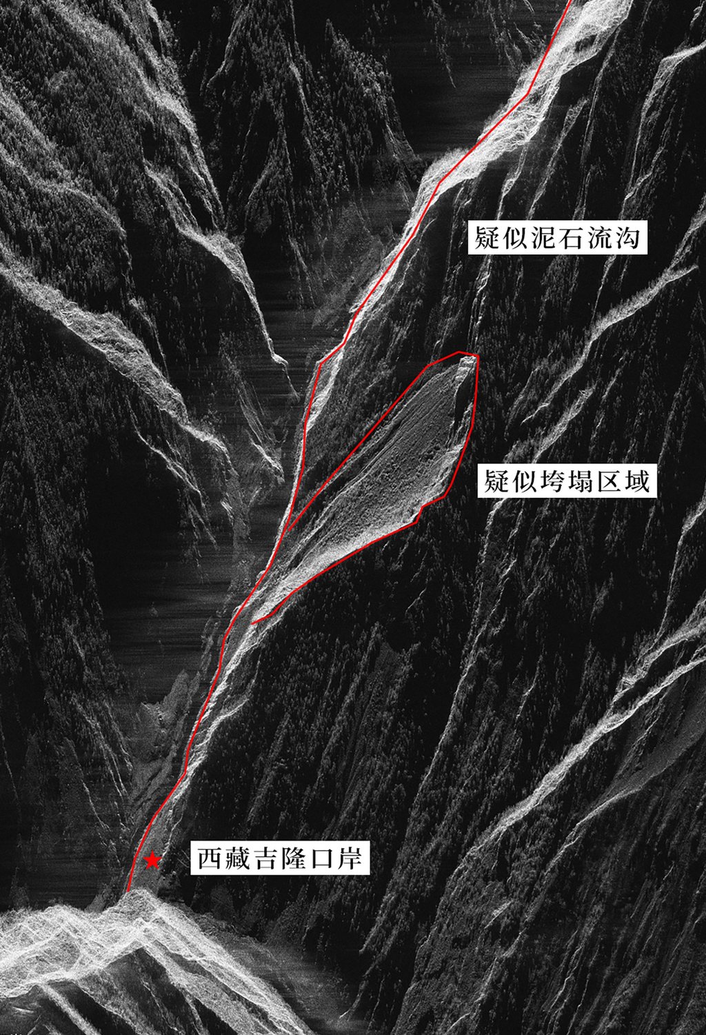
The surveying mission utilized sophisticated Synthetic Aperture Radar (SAR) technology, specifically through the Dongpo-15 and Dongpo-19 satellites. Unlike traditional optical sensors, which rely on visible light and are frequently blinded by the heavy cloud cover, mist, and persistent haze common to the Himalayan plateau, SAR sensors emit radar pulses that pierce through atmospheric interference. By measuring the signals that bounce back from the Earth’s surface, these satellites can map changes in terrain with millimeter-level precision, regardless of lighting or weather conditions.
The data released by Beijing Minospace Technology included detailed radar imagery of the suspected collapse site near a remote mountain pass on the Nepalese side of the border. The imagery identified three critical areas: the primary collapse zone where a massive section of the glacier sheared away, the subsequent mudslide gully carved out by the descending mass, and the downstream impact zones including the Gyirong Port border checkpoint.
For geological experts, this data is invaluable. The high-resolution radar maps show the "scarring" of the landscape, allowing researchers to calculate the volume of ice and rock displaced during the event. Preliminary estimates suggest that millions of cubic meters of material were mobilized within seconds, creating a kinetic force that obliterated everything in its path.
Chronology of a Trans-Border Catastrophe
The timeline of the disaster illustrates the terrifying speed of glacial events in the "Third Pole," a region containing the largest reserve of freshwater ice outside the polar regions.
- Wednesday Morning: A massive section of a glacier on the Nepalese side of the border, destabilized by seasonal temperature fluctuations and internal meltwater pressure, underwent a catastrophic structural failure. The resulting avalanche descended thousands of vertical feet, gaining mass as it picked up boulders and soil.
- Wednesday Mid-day: The avalanche struck a glacial lake or a high-altitude river system, triggering a flash flood known as a Glacial Lake Outburst Flood (GLOF) or a related debris flow. The surge moved down the valley toward the China-Nepal border.
- Wednesday Afternoon: The wall of water and debris struck downstream settlements and the Gyirong Port border crossing in Shigatse, Tibet. Infrastructure was overwhelmed, and communications were severed as power lines and cellular towers were swept away.
- Within Hours of the Event: Beijing Minospace Technology received reports of the disaster and initiated an emergency tasking protocol. Orbital trajectories for six satellites were adjusted to ensure a revisit window over the coordinates of the Gyirong region.
- Thursday, August 27: The Dongpo-15 and Dongpo-19 satellites successfully captured high-resolution SAR images. These were processed and analyzed in Beijing, providing the first comprehensive visual evidence of the extent of the damage to Gyirong Port and the surrounding mountain passes.
Human and Economic Toll
The scale of the tragedy is immense. Official reports from both Kathmandu and Lhasa indicate a combined death toll exceeding 400, with the number of missing persons suggesting the final count could rise significantly. In Nepal, entire mountain villages were reportedly buried under several meters of silt and rock. On the Chinese side, the Shigatse region bore the brunt of the impact.
Gyirong Port, a vital artery for trade between China and Nepal, suffered "severe damage," according to local authorities. As the primary land gateway for goods moving between the two nations, the closure of the port has immediate economic implications. The checkpoint is a cornerstone of the Trans-Himalayan Multi-Dimensional Connectivity Network, a part of the broader Belt and Road Initiative. The destruction of warehouses, customs facilities, and the primary access roads will likely disrupt bilateral trade for months, if not longer.
The disaster has also left thousands of residents in the Shigatse prefecture displaced. Emergency shelters have been established, but the delivery of aid is hampered by the fact that the very terrain the satellites are monitoring has become a chaotic maze of unstable mud and debris.
The Role of Private Enterprise in Space Surveillance
The involvement of Beijing Minospace Technology represents a maturing of the Chinese commercial space industry. Traditionally, the People’s Liberation Army or the China National Space Administration (CNSA) would be the sole providers of such high-stakes intelligence. However, following policy shifts in 2014—specifically Document 60, which encouraged private investment in the space sector—companies like Minospace have emerged.
The advantage of commercial satellite operators lies in their operational flexibility. While state assets may be tied to strategic defense priorities, private firms can pivot their constellations toward humanitarian crises or environmental monitoring at a moment’s notice. Furthermore, the data generated by private firms is often easier to share with international NGOs and foreign governments, fostering a level of transparency that is often absent in military-led operations.
"The ability to redirect half a dozen satellites within hours is a testament to the sophisticated ground control and mission planning software now available to the commercial sector," noted one aerospace analyst. "It demonstrates that China’s ‘NewSpace’ ecosystem is not just about launching rockets, but about providing actionable intelligence when time is of the essence."
Environmental Context: The Warming Third Pole
The glacier collapse is not an isolated incident but rather a symptom of broader environmental shifts in the Hindu Kush Himalaya (HKH) region. Scientific studies have consistently shown that the Himalayas are warming at a rate significantly higher than the global average. This "elevation-dependent warming" leads to the thinning of glaciers and the formation of unstable glacial lakes.
When glaciers melt, water can trap itself behind natural dams of loose rock and ice (moraines). If these dams break—or if a massive avalanche falls into the lake, as appears to have happened in this case—the result is a catastrophic flood. Researchers from the International Centre for Integrated Mountain Development (ICIMOD) have previously warned that the frequency of such "multi-hazard" events is likely to increase as permafrost thaws and glacial structural integrity weakens.
The Gyirong region is particularly vulnerable due to its steep topography and the concentration of human activity along river valleys. The data captured by the Dongpo satellites will likely be used by glaciologists to study the "pre-event" conditions of the glacier, searching for signs of deformation that might have been missed in earlier surveys.
Broader Implications and Future Outlook
The disaster and the subsequent satellite response highlight several critical themes for the future of regional security and disaster management.
First, there is an urgent need for an integrated regional early-warning system. While satellites can provide a "post-mortem" of a disaster, real-time sensors on the ground—linked to satellite relay stations—could potentially provide minutes or hours of warning to downstream communities. The success of the Dongpo satellites in mapping the zone suggests that a permanent, commercial-led monitoring service for high-risk glaciers could be a viable business model that also serves the public good.
Second, the event underscores the importance of cross-border cooperation. Disaster relief in the Himalayas is inherently international. The fact that a Chinese company provided the most detailed imagery of a collapse that began in Nepal suggests that data-sharing protocols between Beijing and Kathmandu will be essential for future recovery and reconstruction efforts.
Finally, the resilience of infrastructure in the face of climate change is now a top priority for planners. The damage to Gyirong Port serves as a wake-up call for engineers working on high-altitude projects. Future construction along the China-Nepal border will need to account for the increased risk of GLOFs and massive landslides, potentially requiring the relocation of key facilities to higher, more stable ground.
As search and rescue operations continue under grueling conditions, the six satellites of the Dongpo constellation remain in orbit, continuing their silent vigil over the Himalayas. Their data will eventually form the basis of the reconstruction plan, providing a digital blueprint of a landscape that has been irrevocably changed by the power of nature and the shifting climate of the 21st century.
