

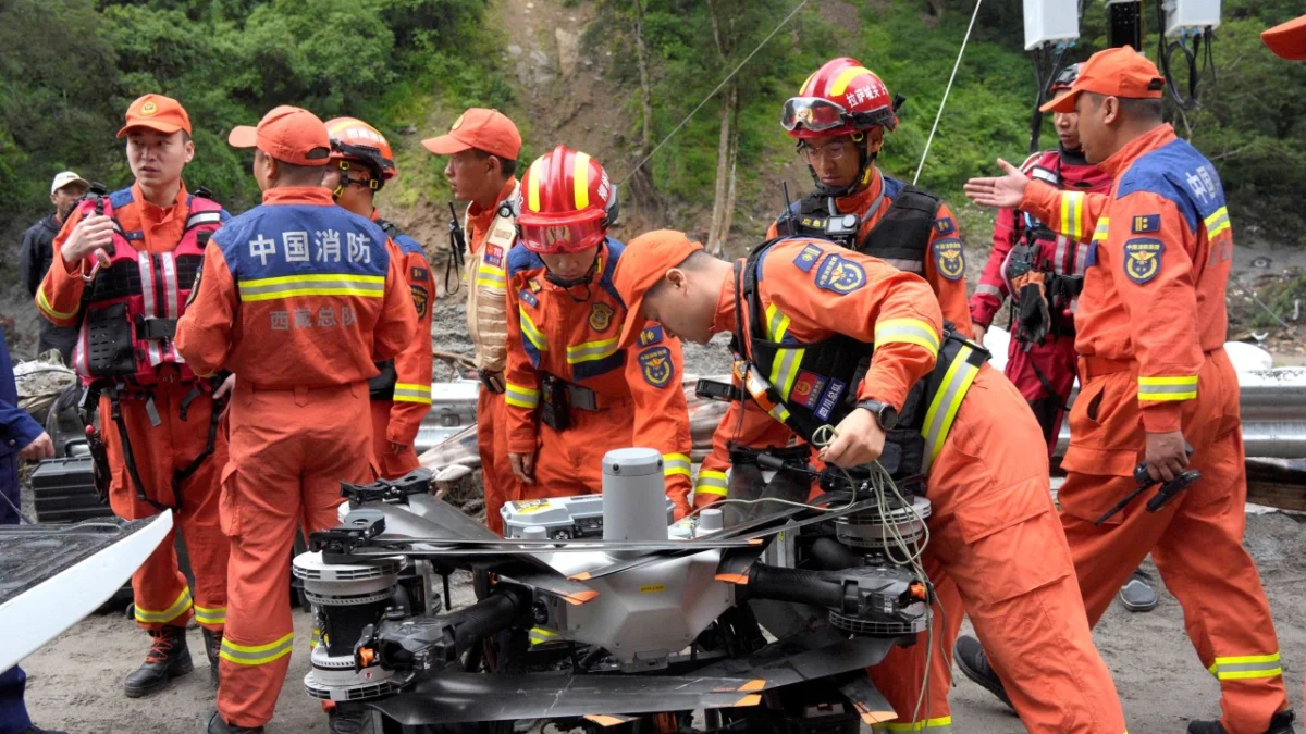
The death toll from the catastrophic flash floods and mudslides that decimated the Gyirong Port border crossing between China and Nepal continued to climb on Friday, as newly released satellite imagery provided a harrowing look at the total devastation of the region. Rescue teams on both sides of the Himalayas are currently engaged in a desperate race against time to locate over a thousand individuals still unaccounted for following Wednesday’s disaster. As of Friday morning, official reports from the Chinese side of the border confirmed three deaths and 558 people missing. However, the situation in Nepal has proven even more dire, with 469 confirmed dead and at least 644 people missing in the wake of the fast-moving debris flow.
The tragedy unfolded with terrifying speed on Wednesday morning when a massive Himalayan landslide triggered a high-velocity debris flow. This geological event, likely exacerbated by recent seasonal rains and the fragile nature of the high-altitude terrain, sent a torrent of mud, boulders, and water screaming down the narrow mountain valleys toward the Gyirong Port—a vital artery for trade and transit between the two nations. According to data provided by the state broadcaster CCTV, the torrent reached speeds of up to 200km/h (124mph) as it descended. Witnesses and technical sensors described a literal wall of water and debris, estimated at 15 meters (50 feet) in height, which slammed into the border checkpoint and surrounding infrastructure with the force of a tectonic shift.
Chronology of the Disaster
The sequence of events began in the early hours of Wednesday in the high-altitude reaches above Gyirong county, located in Tibet’s Shigatse prefecture. While the exact trigger is still under investigation by geological experts, preliminary assessments suggest that a significant slope failure occurred on a saturated mountainside, possibly following a localized but intense weather event. By approximately 9:00 AM local time, the landslide transitioned into a debris flow, gaining mass and momentum as it incorporated saturated soil and glacial runoff.
By the time the flow reached the Gyirong Port area, it had become an unstoppable force. The 15-meter wall of water hit the border facilities with such intensity that many structures were obliterated instantly. The Nepal-China Friendship Bridge, a critical piece of infrastructure symbolizing the diplomatic and economic ties between the two countries, was completely washed away. Following the initial impact, the sheer volume of silt and debris was so immense that it physically altered the course of the river channel, creating new flood zones and burying roads under several meters of mud.
Throughout Thursday and Friday, the focus shifted from immediate survival to large-scale search and recovery. Satellite images released by the state news agency Xinhua on Thursday evening illustrated the scale of the burial; what were once bustling residential areas and customs offices are now indistinguishable from the grey, muddy landscape.
Assessing the Human and Physical Toll
The disparity in casualty numbers between the Chinese and Nepalese sides reflects the differing population densities and infrastructure layouts near the border. In Gyirong county, the 558 missing persons include port workers, local residents, and truck drivers who were caught in the path of the flow. The Chinese government has deployed specialized search and rescue units, including elements of the People’s Liberation Army (PLA) and the People’s Armed Police, equipped with life-detection instruments and heavy machinery to dig through the compacted silt.
In Nepal, the impact was felt across a wider area of the Rasuwa District. The confirmed death toll of 469 is expected to rise as recovery teams reach more remote villages that were cut off by the destruction of the Friendship Bridge and the blockage of the Pasang Lhamu Highway. The 644 missing individuals in Nepal represent a significant portion of the local border community, highlighting the vulnerability of settlements situated in the steep valleys of the Himalayas.
The physical damage to the Gyirong Port—one of the few remaining functional land routes for heavy trade between China and Nepal—is near-total. Beyond the loss of the bridge, the silt deposits have obscured the original terrain to such an extent that engineers believe it may take months, if not years, to fully restore the port’s operational capacity.
Geological Context and Environmental Factors
The Himalayas are among the most geologically active and fragile regions in the world. Experts from the Chinese Academy of Sciences and international geological surveys note that the Gyirong region is particularly susceptible to "cascading hazards." This occurs when one event, such as a landslide, triggers a secondary event, such as a debris flow or a glacial lake outburst flood (GLOF).
The speed of the Wednesday flow—200km/h—indicates a high degree of fluidization, where the ratio of water to solid material allows the mass to behave like a liquid while maintaining the destructive density of solid rock. This "slurry" effect is what allowed the debris to reach a height of 15 meters, easily overtopping existing flood defenses and reinforced structures at the port.
Furthermore, the timing of the disaster coincides with the latter half of the monsoon season. Saturated soils in the high-altitude regions of Tibet and northern Nepal often reach a tipping point where even a minor seismic tremor or an additional hour of rainfall can trigger a massive failure. Climate change is also being scrutinized as a contributing factor, as rising temperatures in the "Third Pole" lead to more frequent extreme weather events and the destabilization of permafrost and glacial moraines.
Official Responses and International Cooperation
The response from Beijing was immediate. President Xi Jinping and the State Council have issued directives to prioritize the "preservation of life" and to spare no effort in the search for the missing. The Ministry of Emergency Management has established a field headquarters in Shigatse to coordinate the logistics of the rescue operation. Large quantities of relief supplies, including tents, food, and medical equipment, are being moved toward the border, though the destruction of the main road has forced much of the transport to be conducted by helicopter.
In Kathmandu, the Nepalese government has declared a state of emergency in the Rasuwa District. Prime Minister Pushpa Kamal Dahal expressed deep condolences to the families of the victims and called for international assistance in the recovery efforts. The Nepal Army and Armed Police Force have been deployed to the site, though they face significant challenges due to the lack of heavy equipment on the Nepalese side of the border following the bridge’s collapse.
Diplomatic channels between China and Nepal remain open as the two nations coordinate their response. There are reports of "cross-border rescue cooperation," where Chinese aerial assets have been used to survey damage on the Nepalese side, providing critical data to teams on the ground in Nepal who are otherwise operating in a communication vacuum.
The Strategic and Economic Impact
The destruction of the Gyirong Port is a significant blow to the regional economy. Following the 2015 Gorkha earthquake, which severely damaged the Zhangmu (Tatopani) border crossing, Gyirong emerged as the primary land link for the Belt and Road Initiative (BRI) projects in Nepal. It serves as the main conduit for Chinese electronics, machinery, and consumer goods entering Nepal, as well as Nepalese agricultural products moving north.
The loss of the Nepal-China Friendship Bridge effectively severs this connection. With the Zhangmu crossing still operating at limited capacity and other mountain passes being unsuitable for heavy logistics, Nepal faces a potential supply chain crisis. The cost of rerouting goods through sea ports in India will significantly increase the price of essential commodities in Kathmandu and beyond.
For China, the disaster represents a setback in its efforts to enhance trans-Himalayan connectivity. The Shigatse-Gyirong railway, a planned extension of the Qinghai-Tibet railway, was intended to eventually link with the Nepalese rail network. The geological instability demonstrated by Wednesday’s disaster will likely lead to a re-evaluation of the engineering requirements and safety protocols for such ambitious infrastructure projects.
Broader Implications and the Path Forward
This disaster serves as a grim reminder of the inherent risks of infrastructure development in the high Himalayas. As both China and Nepal seek to increase connectivity, the "natural barrier" of the mountains remains a formidable opponent. The scale of the missing persons list—totaling over 1,200 people across both sides—suggests that early warning systems were either non-existent or insufficient to provide enough lead time for evacuation.
Future recovery efforts will need to focus not only on rebuilding what was lost but on implementing more robust monitoring systems. This includes satellite-based landslide monitoring, automated river gauges, and community-based alert systems that can function in the remote, high-altitude environment.
As the sun sets on Friday, the window for finding survivors is rapidly closing. The compacted nature of the debris flow makes "pockets of air"—which often allow survivors to persist in earthquake rubble—extremely rare. Nevertheless, the rescue teams in Gyirong and Rasuwa continue to work under floodlights, driven by the hope of finding those still lost in the mud. The tragedy at Gyirong Port will undoubtedly be remembered as one of the most devastating natural disasters in the history of the China-Nepal border, reshaping both the physical landscape and the strategic approach to Himalayan development for decades to come.
