

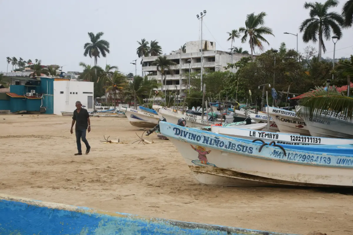
Hurricane Trudy, the latest in a relentless series of tropical systems to target Mexico’s Pacific seaboard this year, maintained its formidable strength as it advanced toward the country’s western coastline on Saturday morning. Meteorological experts and government officials have issued urgent advisories, warning that the storm could undergo further intensification before it begins a projected weakening trend late Sunday. As the system churns through the Pacific, a comprehensive hurricane warning has been established, spanning from the major port city of Manzanillo in Colima state to the rugged coastline of Cabo Corrientes in Jalisco. The arrival of Trudy represents a significant threat to a region already grappling with the cumulative effects of a hyperactive storm season, where the landscape has been rendered vulnerable by weeks of persistent precipitation.
Current Meteorological Status and Trajectory
According to the latest bulletin from the United States National Hurricane Center (NHC), Hurricane Trudy was positioned approximately 305 kilometers (190 miles) south-southeast of Manzanillo early Saturday. The storm’s internal structure has remained organized, sustaining maximum winds of 150 km/h (90 mph), which places it firmly within the Category 1 range on the Saffir-Simpson Hurricane Wind Scale. While currently a Category 1 storm, the atmospheric conditions over the warm Pacific waters remain conducive to slight strengthening in the short term.
The hurricane is currently tracking in a north-northwesterly direction at a relatively slow forward speed of approximately 13 km/h (8 mph). This slow movement is a primary concern for meteorologists, as it increases the duration of time the storm’s rain bands will hover over specific geographic areas. The NHC’s forecast indicates that Trudy will approach the southwestern and west-central coasts of Mexico later Saturday afternoon, with the center of the storm expected to pass near or over the coastline overnight and into the early hours of Sunday morning.
The transition of weather conditions is expected to be rapid. While tropical storm-force winds are already beginning to lash the outer regions of the warning zone, full hurricane conditions—characterized by sustained winds exceeding 119 km/h (74 mph)—are anticipated to manifest within the warning area by Saturday night. Areas currently under a hurricane watch, which indicates that hurricane conditions are possible but not yet certain, have also been advised to prepare for emergency contingencies.
Rainfall Projections and Hydrological Risks
The most significant threat posed by Hurricane Trudy is not merely the wind, but the immense volume of moisture it carries. Forecasters have issued dire warnings regarding the potential for catastrophic flooding. Across the states of Michoacán, Colima, and Jalisco, Trudy is expected to dump between 10 to 20 centimeters (four to eight inches) of rain through the weekend. However, the NHC has highlighted the danger of isolated "bullseye" totals reaching as high as 38 centimeters (15 inches).
Such extreme rainfall in a concentrated period poses a dual threat. In urban areas and low-lying coastal plains, the risk of life-threatening flash flooding is acute. In the interior, where the Sierra Madre del Sur and other mountain ranges dominate the landscape, the primary concern shifts to landslides and mudslides. The steep terrain of western Mexico is notoriously susceptible to "debris flows"—fast-moving landslides that can bury entire communities and sever vital transportation arteries.
Beyond the core impact zone, the storm’s outer rain bands are expected to lash the states of Guerrero and Nayarit. These regions could see rainfall totals of five to 10 centimeters (two to four inches), with isolated pockets receiving up to 15 centimeters (six inches). While these totals are lower than those expected in the direct path of the eye, they are more than sufficient to cause localized flash flooding and swell river levels to dangerous heights.
Coastal Hazards: Storm Surge and Destructive Waves
In addition to the atmospheric threats, the maritime and coastal environments are facing severe disruption. The NHC has warned of a dangerous storm surge that could lead to significant coastal flooding in areas where the wind blows directly onshore. This surge—a wall of water pushed toward the shore by the force of the hurricane—will be accompanied by large, destructive waves capable of eroding beaches and damaging beachfront infrastructure.
The impact on the ocean is already being felt. Swells generated by Hurricane Trudy have begun to affect the southwestern coast of Mexico and are projected to spread northward toward the west-central coast as the weekend progresses. These conditions create life-threatening surf and rip currents, making any maritime activity or coastal recreation extremely hazardous. Professional mariners and local fishermen have been advised to secure their vessels and remain in port until the system has fully dissipated.
Context of the 2026 Pacific Hurricane Season
The arrival of Trudy is particularly concerning because it follows a string of previous systems that have already tested the resilience of Mexico’s Pacific infrastructure. Earlier this season, the region was battered by Hurricane Simon and Tropical Storm Rachel, both of which contributed to two reported fatalities and significant property damage.
The cumulative impact of these successive storms cannot be overstated. In the state of Colima, local officials have noted that while the immediate risk from Trudy might initially appear manageable, the ground is already heavily saturated. Saturated soil loses its ability to absorb further moisture, meaning that even moderate rainfall from Trudy could trigger immediate runoff, leading to faster river rises and a higher likelihood of slope failure in mountainous regions. This "saturation effect" turns a standard hurricane event into a potential humanitarian crisis, as the natural buffers provided by the earth are effectively neutralized.
Official Responses and Emergency Measures
The Mexican government has mobilized various agencies to mitigate the impact of the approaching storm. The Mexican Navy (Secretaría de Marina) has taken a lead role, issuing a formal directive to the maritime community and residents of coastal settlements. The Navy’s message urged "extreme caution," specifically highlighting the dangers of high waves, torrential rains, and the rapid rising of river levels.
In Colima, the state civil protection authorities have been monitoring the storm’s progress around the clock. While they initially classified the risk as "low" during the storm’s early approach, the tone has shifted to one of high vigilance as the rainfall projections became clearer. Emergency shelters have been identified, and local municipalities have been instructed to clear drainage systems to prevent urban flooding.
In Jalisco, where the popular tourist destination of Puerto Vallarta lies near the northern edge of the warning zone, local businesses have begun boarding up windows and securing outdoor furniture. The state government has emphasized that the rugged terrain near Cabo Corrientes is particularly vulnerable to isolation if roads are washed out by landslides.
Economic and Infrastructure Implications
The path of Hurricane Trudy places several key economic hubs at risk. Manzanillo is home to one of Mexico’s busiest and most vital commercial ports, serving as a primary gateway for international trade. Any prolonged closure of the port or damage to its container handling facilities could have ripple effects throughout the national economy and international supply chains.
The tourism sector, a cornerstone of the economy in Jalisco and Nayarit, also faces a significant setback. October is typically a month where the region prepares for the peak winter tourism season. Physical damage to resorts, coupled with the negative publicity of a major storm, could lead to cancellations and a delayed start to the high season.
Furthermore, the agricultural sector in Michoacán and Colima is under threat. These states are major producers of avocados, limes, and bananas. Excessive rainfall and high winds can strip fruit from trees, drown root systems, and destroy the infrastructure used to transport produce to markets. For local farmers, Trudy represents not just a weather event, but a potential threat to their annual livelihood.
Analysis of the Weakening Trend
Forecasters anticipate that Trudy will begin to lose its hurricane-force strength on Sunday. This weakening will likely be caused by two factors: interaction with the mountainous terrain of mainland Mexico and a transition into an environment with higher wind shear or cooler sea surface temperatures. However, meteorologists caution that a "weakening" storm can often be more deceptive and dangerous than a strengthening one.
Even as wind speeds decrease, the system’s ability to produce torrential rain remains intact. In many historical cases, the most devastating floods have occurred after a hurricane was downgraded to a tropical depression, as the system stalls over land and continues to wring out moisture from the atmosphere. Residents are being warned not to lower their guard simply because the storm’s category rating may drop on Sunday.
Public Safety Advisory and Conclusion
As Hurricane Trudy makes its final approach, the priority for all residents in the affected zones remains the preservation of life. Authorities have issued the following recommendations:
- Evacuate if Advised: Residents in low-lying areas or on unstable slopes should follow evacuation orders immediately.
- Stockpile Essentials: Families should have at least three days’ worth of water, non-perishable food, and medical supplies.
- Stay Informed: Monitor local radio, television, and official social media channels for real-time updates from the NHC and Mexican Civil Protection.
- Avoid Travel: Flooded roads can be deceptive; "Turn around, don’t drown" remains the primary advice for motorists.
- Maritime Safety: All small craft should remain moored, and beachgoers must stay away from the shoreline due to the risk of rogue waves and rip currents.
Hurricane Trudy serves as a stark reminder of the increasing volatility of tropical weather systems and the vulnerability of coastal populations. With the ground already soaked from previous encounters with Simon and Rachel, the margin for error is slim. The coming 48 hours will be a critical period for western Mexico as it braces for the full impact of the storm, hoping that the preparations made in the preceding days will be sufficient to weather the latest challenge from the Pacific.
